
What to see on the Cíes Islands: beaches, lighthouses and viewpoints
A guide to the Cíes Islands: what to see, walks to the lighthouses and viewpoints, Rodas beach and how to combine the trip with Tui and Soutomaior.
In this article
The listings our algorithm suggested for this topic were all about Mallorca, but the Cíes Islands are at the opposite end of the country: at the mouth of the Ría de Vigo, off the coast of Pontevedra. So we're leaving the Mediterranean behind and heading to Galicia's Atlantic coast, to one of the most photographed archipelagos in Spain.
An archipelago at the mouth of the ría
The Cíes are three islands: Monteagudo to the north, Faro island in the middle and San Martiño to the south. The first two are joined by a sandbar and a small lagoon, and between them lies the image almost everyone has in mind: a crescent of white sand and crystal-clear water. Facing the open sea, however, the islands show their other side, with towering cliffs battered by wind and waves.
Since 2002 they have been part of the Atlantic Islands of Galicia National Park, together with other archipelagos such as Ons, Sálvora and Cortegada. That protection explains much of what you'll find when you arrive: there are no cars, visitor access is regulated and the landscape is preserved with a care rarely seen on the coast.
A little history
The islands have been inhabited since ancient times, with remains from the Castro culture and the Roman period. In the Middle Ages there was a monastic presence, and for centuries they were visited by pirates and privateers who used their shelter to lie in wait over the ría; Drake's fleet is said to have anchored in these waters. Later came fish-salting factories and a handful of inhabitants who lived here until the mid-20th century. Today, all that remains of that life are a few scattered buildings, the lighthouses and the paths that link them.
What to see on the Cíes Islands
The islands are explored on foot, along a network of waymarked trails that set off from around the jetty. These are the main stops:
- Rodas beach: the great stretch of sand joining Monteagudo and Faro island. Fine sand, very clear, cold water and a view over the ría that's hard to forget.
- Lago dos Nenos: the lagoon behind Rodas, a small ecosystem of mixed waters best admired without stepping in.
- Cíes Lighthouse: at the top of Faro island, this is the best-known route. The climb is steep, but the panorama over the cliffs and the ocean makes the effort worthwhile.
- Pedra da Campá: a wind-eroded rock with a natural hollow, halfway up to the lighthouse.
- Alto do Príncipe: a viewpoint over the western side of Monteagudo, with a natural stone balcony above the cliffs known as the Queen's Chair.
- Porta Lighthouse and Peito Lighthouse: shorter, quieter routes to the far ends of the islands, ideal if you want to escape the busiest areas.
The islands are also an important spot for seabirds, with large gull colonies. During the breeding season, stick to the paths and keep away from the nests.
Planning your visit
The Cíes are reached by boat from the shores of the ría; in season there are sailings from Vigo and other nearby ports. Because the number of daily visitors is capped, you need a prior permit, which must be obtained before buying your ticket. Always check the official conditions in advance, as they change with the season and in summer places go fast.
Some common-sense tips:
- Wear comfortable shoes: even if you're heading for the beach, the routes to the lighthouses have steep sections.
- Protect yourself from sun and wind: there's little shade up high and the Atlantic weather changes quickly. An extra layer never goes amiss.
- Water and food: facilities are scarce, so it's best to come well stocked.
- Take your rubbish home: there are no bins in the national park and visitors are asked to take out everything they bring in.
- Get up early: the first boats let you do the walks while it's still cool and enjoy Rodas before it fills up.
Summer is the season with the most sailings, but spring and early autumn offer quieter islands when boats are running.
Round off your trip in southern Pontevedra
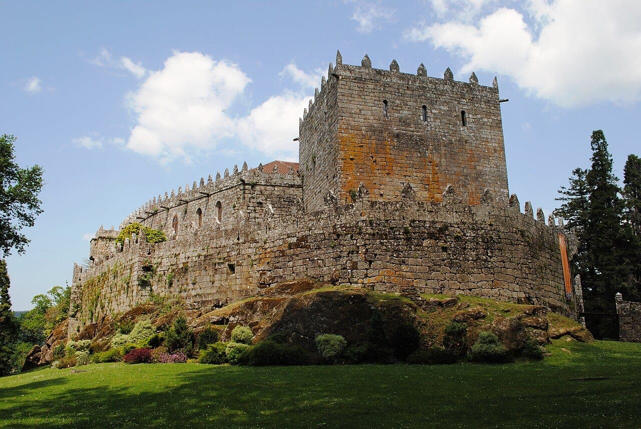
If you have a couple of extra days, the ría and its surroundings are rich in heritage. Inland, Soutomaior Castle is a medieval fortress surrounded by gardens, a very pleasant visit after the sun of the islands.
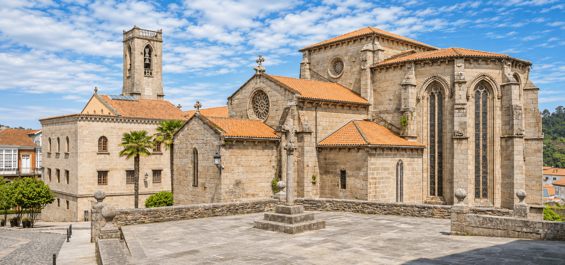
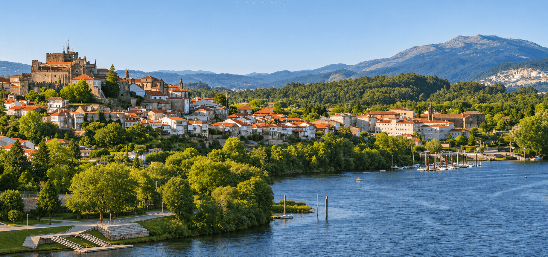
To the south, by the Miño and the border with Portugal, lies Tui, with an old town of cobbled streets climbing up to Tui Cathedral (Santa María), a fortress-like church overlooking the river. Nearby, in the same province, the Church of Nuestra Señora de los Placeres lets you follow the thread of the area's religious heritage.
And if your trip continues north, Santiago de Compostela Cathedral is within reasonable distance to round off your Galician route in style.
In short
The Cíes Islands are a day trip that needs planning ahead: permit, boat, a well-packed rucksack and a willingness to walk. In return, they offer one of the most beautiful beaches in the country, lighthouses with ocean views and a protected landscape best enjoyed calmly and respectfully. And most importantly, make sure you have your boat tickets so you can actually make the trip.
The route in this article
5 stops · 128.6 km by car. See them on the map and plan the trip in a couple of steps.
Guides by style
Places in this article
 Village
Tui
An episcopal city overlooking the Miño, facing Portugal, with a fortress-like cathedral, Baroque and Gothic convents and Monte Aloia, full of hillfort mysteries.
 Cathedral
 of Santa María (Tui)
Romanesque in origin and later reworked in the Gothic style, Tui Cathedral crowns the highest hill in the town, overlooking the River Miño and the border with Portugal.
 Castle
Soutomaior Castle
The medieval fortress of the Soutomaior family, transformed into a Neo-Gothic palace and museum, surrounded by a botanical garden with centuries-old trees and an award-winning camellia collection.
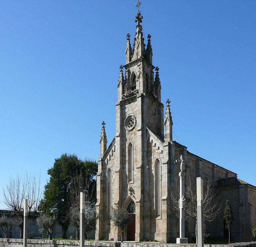 Church
 of Our Lady of Placeres
A late 19th-century Neo-Gothic church in Placeres, Lourizán, built on the site of an earlier chapel at the end of the bar of the port of Pontevedra.
 Cathedral
Santiago de Compostela Cathedral
The final destination of the Camino de Santiago and, according to tradition, the resting place of the tomb of the Apostle, Compostela's cathedral was one of the great pilgrimage destinations of medieval Europe.
Article written with the help of artificial intelligence based on Wikipedia (CC BY-SA 4.0) and our catalogue, and reviewed by the El Trotamundos Curioso team.